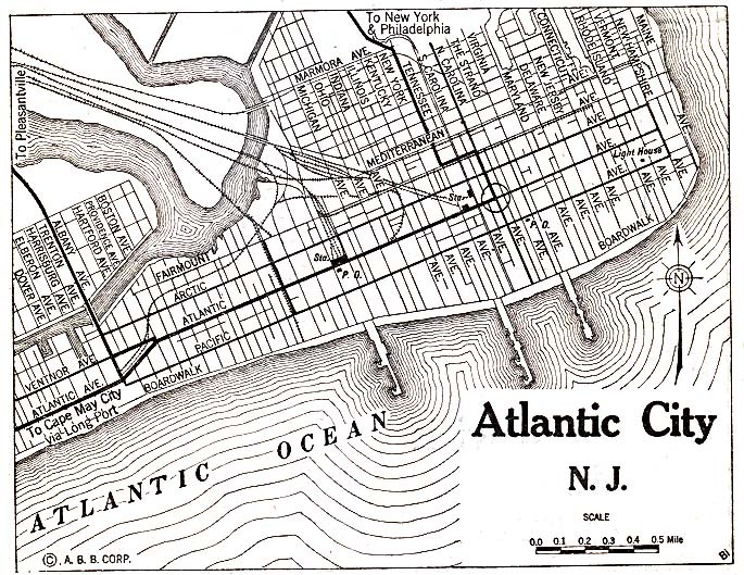
Map of Atlantic City, New Jersey 1920
This map of Atlantic City displays major railroads, the grid of avenues named after the states and world oceans, the Boardwalk, and the three main piers. From left: Young's Million Dollar Pier (1906), Central Pier (1884), Steel Pier (1898).
The majority of Atlantic City's development occurred between Atlantic Avenue and the Boardwalk, with the most opulent hotels and stores built directly along the Boardwalk's northern edge.
The area north of Atlantic Avenue between Connecticut and Arkansas Avenues was referred to as the "Northside", a predominantly African American city within a city.
