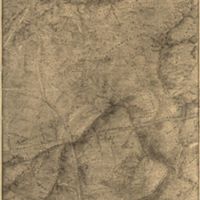
Topographical map of the Bull Run battle-field. [1861]
Dublin Core
Title
Topographical map of the Bull Run battle-field. [1861]
Description
A map made for General Beauregard after the the first battle of Bull Run from actual surveys by Captain D. B. Harris. This is a reproduction by General Abbot from a photograph in his possession
--from the description under the map
This map is highly detailed with roads, major highways, different types of trees and mountains clearly defined. The amount of detail drawn into this map means that the artist surveyed the land quite closely and wanted an accurate depiction of the area. The different labeled parts showing where different houses, farms and type of lands were located helps to locate areas of land. However, since this was created as a map of the battlefield, the actual boundaries of the battle are not well labeled. Only someone who knew where the battle took place would be able to find that area on the map. To an outsider, it just looks like a topographical map of land. However, since this map was made for a general of the army, it makes sense that he would know where certain battles were fought and would not need the area marked off.
Creator
Captain D. B. Harris and Mr. John Grant
Publisher
Library of Congress
Date
1861
Identifier
http://tile.loc.gov/image-services/jp2.py?data=/service/gmd/gmd388/g3884/g3884m/cw0564400.jp2&res=1
Files
Citation
Captain D. B. Harris and Mr. John Grant, “Topographical map of the Bull Run battle-field. [1861],” Materiality and Spectacle 2015, accessed February 2, 2026, https://ds-omeka.haverford.edu/materiality-and-spectacle-2015/items/show/32.
